Let's meet
Level 16, Wisma UOA Damansara II, No 6, Changkat Semantan, Bukit Damansara Kuala Lumpur, 50490 Malaysia
360 virtual tour services help showcase Malaysia townships and integrated developments with immersive visuals that boost buyer interest.
Posted by Daniel Taufik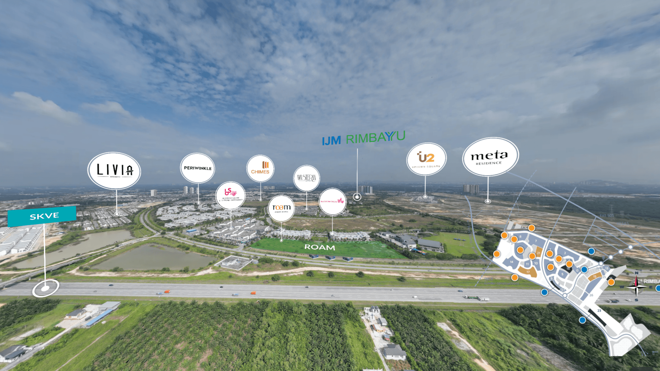
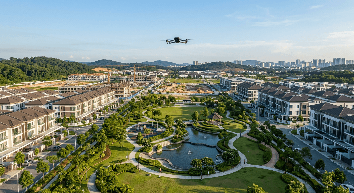
Master-planned townships and integrated developments in Malaysia are growing larger, denser, and more experience-focused. Mixed-use components, lifestyle hubs, smart infrastructure, and multi-phase rollouts make them exciting, but harder to explain. Buyers, tenants, and investors want to understand not only floor plans, but how everything connects across the wider site.
Click to View 360 Virtual Tour of Gamuda Cove

At Gamuda Cove, we created an aerial virtual tour that supports its nature-inspired, smart township positioning. Aerial views show wetlands, parks, and attractions, while 360 scenes cover key residential and lifestyle zones. Hotspots help prospects understand how roads, recreational areas, and future components connect to the masterplan.
Click to View 360 Virtual Tour of IJM Rimbayu

For IJM Rimbayu, we highlighted its eco-centric, community character. The tour features tree-lined boulevards, community hubs, and residential precincts, with smooth transitions between anchors like clubhouses and commercial areas. Aerial views show access points and traffic flow, while ground-level 360 scenes show parks, streets, and gathering spaces. A neighbourhood guide and aerial mapping layer add context, and the Map button displays categorized landmarks for quick amenity checks.
Click to View 360 Virtual Tour of Bandar Seri Coalfields

At Bandar Seri Coalfields, the tour reflects its transformation into a family-friendly township. Aerial perspectives show housing clusters, commercial pockets, and schools in relation to one another. Multiple 360 viewpoints help buyers see how retail, education, and open spaces are distributed. The experience also integrates 3D renders of the show unit, allowing virtual interior visits before the physical unit is built.
Click to View 360 Virtual Tour of Taman Bukit Kepayang

In Taman Bukit Kepayang, our aerial virtual tour positions the township as a strategic address near Seremban. Aerial sequences highlight highway connectivity and the township’s relationship to the wider urban area. Viewers can then enter street-level 360 scenes to understand the feel of existing and upcoming phases. The tour integrates 3D renders of the show unit so buyers can walk through homes before construction, linking township context with interior living.
Click to View 360 Virtual Tour of Klemeru

For Klemeru near Ipoh, we used immersive visuals to highlight residential clusters, surrounding landscape, and access routes. Drone shots show how the project sits within the broader environment, while interior 360 views connect outdoor lifestyle with living spaces. The tour includes mixed render, blending 3D rendered buildings into real-world views to show the development’s future form.
Click to View 360 Virtual Tour of Uplands

With Uplands, we emphasized interactive home design and virtual walkthroughs. Prospects can explore layouts, space planning, and views from different vantage points to assess fit for daily life. The tour integrates 3D renders of the show unit for room proportions and finishes before the physical unit exists. Paired with township-scale imagery, buyers can evaluate location and unit in one digital flow.
Click to View 360 Virtual Tour of Lido Waterfront Boulevard

At Lido Waterfront Boulevard, the core story is waterfront positioning and integrated lifestyle. Aerial passes show the coastline, skyline, and promenade, while hotspots highlight retail zones, recreation areas, and public spaces as one connected destination. Mixed render blends 3D rendered buildings into the real environment to illustrate the completed scheme. A neighbourhood guide and aerial mapping view add context, and the Map button shows categorized landmarks, from shopping and dining to transport links.
Coming Soon: Click to View 360 Virtual Tour of Princess Cove

For Princess Cove, cross-border proximity to Singapore is key. The tour showcases views of the Causeway, seafront orientation, and premium towers, helping local and international buyers understand its strategic location. Multiple 360 vantage points support remote evaluation of waterfront views and surrounding infrastructure. Mixed render content blends 3D towers into real-world surroundings to show how the completed development fits the cityscape.
Click to View 360 Virtual Tour of Tropicana Cenang

Tropicana Cenang combines resort-style living, commercial offerings, and tourism draw along Pantai Cenang. Our aerial virtual tour uses sweeping beachfront passes with immersive site views so buyers and investors can sense the energy of a beachside integrated development, especially when travel is difficult. A neighbourhood guide and aerial mapping feature let viewers use the Map button to see categorized nearby landmarks, such as attractions, transport, and lifestyle.
For Nada Embun, we focused on the residential setting and greenery. The tour combines ground-level 360 photography and aerial views to highlight openness, community spaces, and ambience, showing how homes relate to shared parks and natural elements.
Large townships are ecosystems. To understand them, viewers need both macro and micro perspectives. Aerial virtual tours provide the big picture, while 360 scenes and interactive walkthroughs add detail.
For developers and marketing teams, this matters because it explains what brochures cannot, such as:
Get in Touch with Actsugi to Create a Township Virtual Tour
Our CAAM-certified drone photography focuses on cinematic, experiential aerials rather than technical photogrammetry, with careful attention to light, composition, and movement. We then connect this with ground-level 360 photography, 360 video, and interactive hotspots inside the virtual tour.
In one interface, viewers can:
For sales and investor relations, this enables remote viewing, faster decision cycles, clearer stakeholder conversations, and a future-ready brand image.
Traditional brochures, static photos, and even physical show units struggle to communicate scale, connectivity, and daily life across hundreds of acres. They can showcase a home or a mall interior, but not how the whole place fits together.
This is where aerial virtual tours and interactive storytelling help. At Actsugi, we create township-scale virtual experiences that let people explore developments from the sky and on the ground, even before a project is fully built, across Malaysia, Singapore, and Indonesia, supported by CAAM-certified drone photography for safe, consistent aerial content.
Get in Touch with Actsugi to Create a Township Virtual Tour
Townships and integrated developments are complex, but they do not have to feel overwhelming. By blending aerial virtual tours with 360 photography, videography, and drone work, we turn multi-phase projects into intuitive, clickable experiences that are easy to understand in minutes.
For developers, hospitality brands, and enterprises, the shift from static marketing to interactive storytelling is becoming central to launch strategies, sales galleries, and investor communication. As buyers increasingly research big decisions online, immersive township tours are a practical way to show what a place will feel like to live, work, or invest in, long before completion. In an era where digital discovery shapes real-world investment, aerial virtual tours and CAAM-certified drone photography are becoming a strategic differentiator for future-focused townships.